


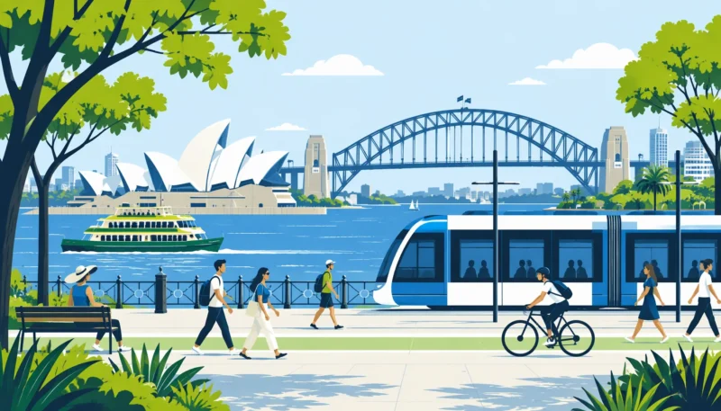
To explore central Sydney without a car, group nearby sights into walking stages and check the light rail or ferry service for longer legs. Circular Quay, George Street and the western waterfront provide useful starting points. Allow for walks between stops, check accessible routes, and plan shade or indoor breaks during hot weather.
- Group nearby waterfront sights into short walking stages.
- Use light rail for suitable city-centre legs and check the current stop and direction.
- Confirm the wharf and departure before treating a ferry as your return trip.
A car-free day in central Sydney can combine waterfront walks with light rail and ferries. Circular Quay links the harbour to the city centre, while George Street provides a rail corridor through the central business district. This itinerary looks at those connections as practical travel choices. It does not estimate the emissions saved by a particular journey.
Key Takeaways: Low-Carbon City Mobility
This route focuses on how people move between central Sydney sights. Short walks connect nearby destinations; public transport provides options when distances, heat or fatigue make another walking leg less appealing. A connected itinerary still needs realistic transfer time and a service that reaches the intended destination.
- Circular Quay is a useful starting point for harbour walks and public transport.
- George Street light rail provides an alternative to walking longer city-centre legs.
- Shade, accessibility and transfer distance belong in the day’s route plan.
- This itinerary describes transport choices, not a measured carbon saving.
The day can begin around Circular Quay, continue through the city centre, and finish at the western waterfront. These are linked areas to explore, not a timed circuit or a promise that every attraction can be visited in a day.
The Pedestrian Hub: Circular Quay and the Waterfront
Circular Quay brings ferry wharves, trains and light rail together near the harbour. From here, pedestrians can head east towards the Opera House or west into The Rocks. Walking time depends on the destination, chosen path and pace; check a map rather than treating the whole waterfront as a fixed twenty-minute catchment.
Walking east towards Bennelong Point follows the waterfront to the Sydney Opera House. The exterior forecourt offers views of the building and harbour; an interior visit needs separate planning. In summer, exposed waterfront paths can be uncomfortable in the midday sun. An early start, drinking water and breaks make this walking stage easier to manage.
From the Opera House, continue into the Royal Botanic Garden for paths through lawns and planted areas. Mrs Macquaries Point offers a view towards the Opera House and Harbour Bridge. Choose a route that suits your walking distance and look for shaded places to rest, rather than assuming that every shoreline stretch is sheltered.
West of Circular Quay, The Rocks offers sandstone buildings, steps and narrow laneways with pubs, shops and cafés. Those streets are a useful walking stop, although steps and uneven surfaces matter when choosing an accessible route. Seasonal markets and Christmas events need a current programme check; their dates and opening hours should not be treated as permanent features of the itinerary.
Light Rail and Shade Corridors Through the City Core
Moving south along George Street brings the route into the central business district. Walk between nearby stops or use light rail for a longer leg. Check the stop, direction and service before boarding. The rail corridor gives travellers another option when heat or walking distance makes a break useful.
The broader planning question is how much street space a city gives to walking and shared transport. The car-free city concept provides background, but this Sydney itinerary does not measure changes in congestion, tram punctuality or emissions. Those outcomes need evidence beyond the existence of a pedestrian street.
- The Queen Victoria Building (QVB): This George Street landmark contains cafés and shops across several levels. Its indoor arcades provide a sheltered stop between walking stages.
- Hyde Park: East of George Street, the park offers lawns and trees between the ANZAC Memorial and the Archibald Fountain. Check the approach and crossings from your current stop.
- Martin Place: This civic plaza is another city-centre walking stop. Check current Christmas event listings before planning an evening around performances or displays.
Multi-Modal Connections: Returning West to the Harbour
Darling Harbour lies west of the city centre. Walk there from a suitable central starting point, or check which light rail stop serves the part of the precinct you want to visit. The waterfront promenade links public spaces, cafés and restaurants, but getting there may still involve road crossings and a walk from the station.
At the western waterfront, choose onward transport by its actual stop and destination rather than assuming all nearby services run directly back to Circular Quay:
- Ferry wharves: Check departures from Barangaroo or Pyrmont Bay against your intended destination. These are distinct wharves, and a direct service should not be assumed.
- Light rail: Check the stop serving your part of Darling Harbour and the service towards Central. The western waterfront is not the same corridor as George Street.
- Trains: Town Hall is an option for onward suburban travel after a walk back towards the city centre. Check the route to the station and current services.
| Mode | Useful role | What to check |
|---|---|---|
| Walking | Nearby sights, parks and waterfront paths | Distance, shade, steps and crossings |
| Light rail | Longer legs on the served city corridors | Stop, direction and walking transfer |
| Public ferry | Harbour journeys between served wharves | Wharf, destination and current departure |
| Harbour cruise | A separately booked sightseeing or dining trip | Operator, boarding point and booking |
Water transport can also be a leisure activity at the end of the walking day. King Street Wharf is a departure point for harbour cruises. Dinner cruises on Sydney Harbour offer views from the water; check the operator’s route, boarding point and departure time. A sightseeing or dinner cruise is a separate booking, not an interchangeable substitute for a public ferry service.
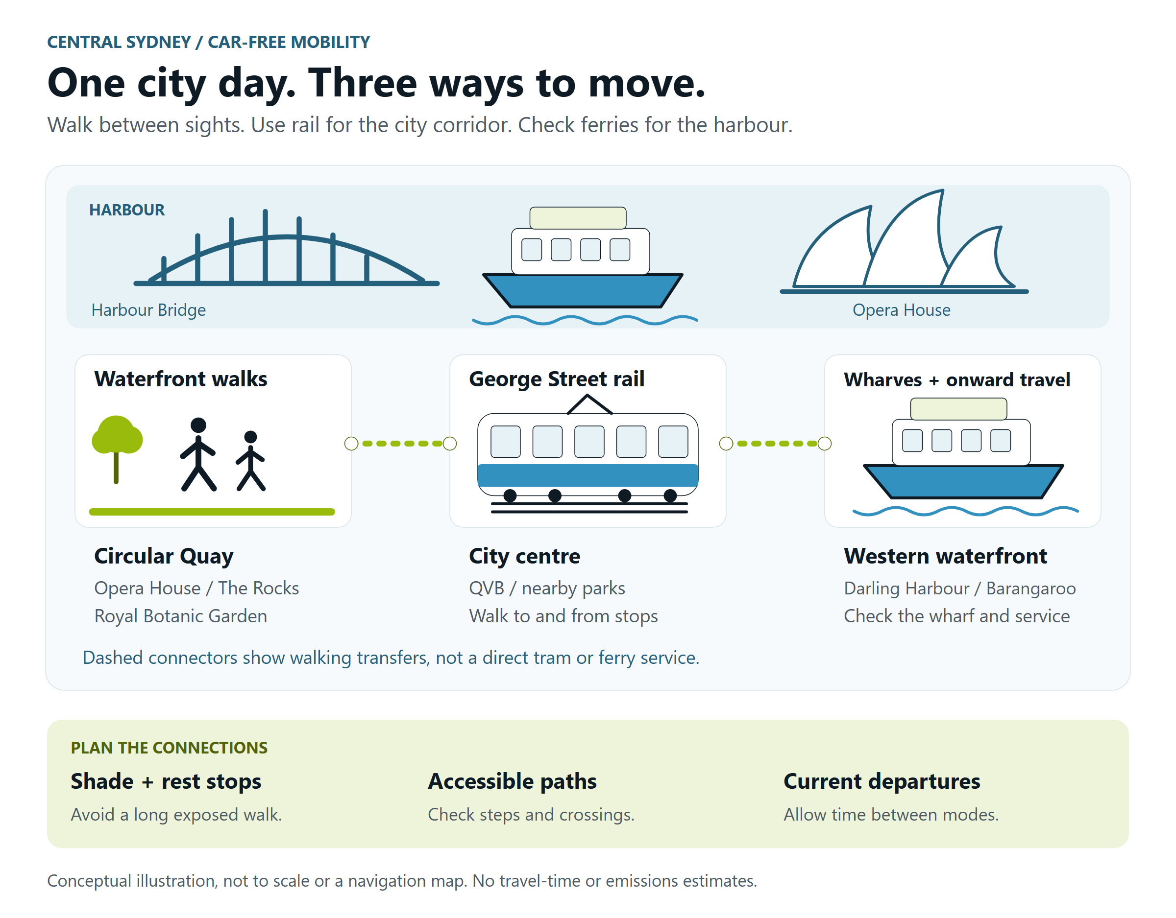
Planning Car-Free Urban Routes and Mode Transfers
Plan the route at the points where a walk becomes a tram, train or ferry journey. Check crossings, steps, shade and the distance between the attraction and the platform or wharf. The car-free movement describes a wider transport debate; it does not prove that Sydney has eliminated transfer gaps. For a historical comparison, Blue & Green Tomorrow’s 2014 report on Bogotá’s sustainable transport covers bus transit, cycle routes and car-free policies in a different urban setting.
FAQ
How can you explore Sydney in a day without a car?
To explore Sydney without a car, begin around Circular Quay and group the Opera House, garden or The Rocks into a manageable walking stage. Use George Street light rail for a suitable city-centre leg, then plan a separate connection to the western waterfront if you want to finish there. Check current services, allow time for transfers and leave room for breaks instead of trying to fit every sight into one day.
How do Sydney’s ferries, light rail and walking paths connect?
Walking connects attractions to stations, light rail stops and ferry wharves. Circular Quay brings several modes together, while the western waterfront requires attention to the particular wharf or stop. George Street and the Darling Harbour light rail approaches should not be treated as a single direct route. Check the service and walking connection for each leg before setting out.
Planning Your Next Car-Free Sydney Day
For your next Sydney visit, choose a few connected areas rather than a list of distant stops. Start with a walking route you can comfortably manage, add rail or a ferry where the service fits, and check the transfer before committing to the next leg. Shade and accessible paths deserve the same attention as departure times. That approach keeps the day practical without pretending that a sightseeing itinerary proves a citywide reduction in traffic or emissions.