

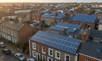
More people are using solar power to lower their environmental footprint. The amount of energy generated by solar power will grow 75% between 2023 and 2025.
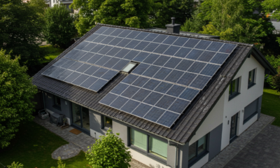
Solar site survey tools are essential for accurately assessing the potential for solar energy at a given location, which helps maximize the benefits of this form of renewable energy. These tools can provide information on a variety of factors, including solar radiation levels, shading, and roof orientation. By using these tools, solar installers, and engineers, can significantly increase the likelihood that a given site will generate solar power. A solar site survey involves the use of various tools and equipment to gather essential data about the site’s suitability for solar installation.
Solar site surveys are going to be more important as solar power becomes more important. One white paper predicts that solar power will be the most important form of renewable energy by 2030, which means the demand for solar site surveys will grow.
Here are some of the key tools commonly used in a solar site survey:
What tools are used in a solar site survey?
When embarking on the journey to harness solar energy through photovoltaic installations, conducting a thorough site survey stands as the foundational step. Matthew Jaglowitz, CEO of Exactus Energy, has performed his fair share of duties as an Exactus Energy Solar site surveyor. He says “The key to this process is the utilization of an array of specialized tools and equipment tailored to assess the intricacies of the site’s terrain, solar exposure, and potential obstructions.”
From cutting-edge drone technology capturing aerial perspectives to precise instruments measuring solar irradiance, each tool plays a vital role in paving the way for efficient and effective solar energy deployment.
Here is a list of the most common tools used:
Drones
As mentioned earlier, drones equipped with high-resolution cameras are used to capture aerial imagery, and topographic data, and perform shading analysis of the site.
GPS Receivers
GPS receivers are used to accurately determine the geographic coordinates and elevation of the site. This information is essential for mapping and designing the solar array layout.
Sun Path Calculators
Sun path calculators or software tools are used to analyze the sun’s path throughout the year at the site location. This helps determine the best orientation and tilt angle for the solar panels to maximize energy production.
Solar Irradiance Meters
Solar irradiance meters measure the amount of solar radiation received at the site. This data helps estimate the potential energy output of the solar panels and assess the site’s solar resources.
Laser Range Finders
Laser range finders are used to measure distances accurately, which is useful for determining the dimensions, and heights of structures, and assessing shading obstacles on the site.
Digital Inclinometers
Digital inclinometers are used to measure the slope or tilt of the terrain. This information aids in designing the solar array to ensure proper drainage and optimal panel orientation.
Sketching and Mapping Tools
Pen and paper, as well as digital mapping software, are used to sketch site layouts, mark potential panel locations, and create detailed maps and reports based on survey data.
Safety Equipment
Safety equipment such as hard hats, safety glasses, high-visibility vests, and appropriate footwear are essential for ensuring the safety of surveyors working on-site.
By utilizing these tools and equipment, solar professionals can conduct comprehensive site surveys to assess the feasibility and design requirements of solar installations accurately. can determine the best location for solar panels and optimize their performance.
Other Apps and Software
One popular tool for solar site surveys is the Solar Pathfinder. This device uses a mirrored dome to capture an image of the surrounding area and project it onto a grid. By analyzing the shadows cast by surrounding objects, the solar pathfinder can determine the amount of shading that will be present at different times of day and year. This information can be used to determine the optimal placement of solar panels and to calculate the expected energy output.
Other solar site survey tools include digital inclinometers, which can be used to measure the angle of a roof or other surface, and pyranometers, which measure the amount of solar radiation at a given location. Together, these tools can provide a comprehensive picture of the solar potential at a site and help solar installers and engineers make informed decisions about the design and installation of solar energy systems.
To cap it off, there are several tools available that can help streamline the solar site survey process. Shading analysis tools, measurement and imaging tools, and solar design software applications can all be used to create an accurate and efficient solar site survey.
Frequently Asked Questions
What tools are essential for conducting a solar site survey?
To conduct a solar site survey, essential tools include a compass, a shading analysis tool, a distance measuring tool, and a solar pathfinder. Additionally, a camera and a notepad for taking notes are also recommended.
How can I perform a solar panel site evaluation effectively?
To perform a solar panel site evaluation effectively, it is essential to assess the shading, orientation, and tilt of the site. Additionally, the solar radiation levels, wind speed, and temperature should be considered. It is also recommended to conduct a thorough electrical analysis of the site.
What should be included in a comprehensive solar site survey report?
A comprehensive solar site survey report should include the site location, shading analysis, solar radiation levels, electrical analysis, and a detailed description of the solar panel system. Additionally, the report should include recommendations for improving the site’s solar potential.
Which mobile applications are recommended for solar site surveys?
Some recommended mobile applications for solar site surveys include SunSurveyor, PVsyst, and Solar Design Tool. These apps can assist with shading analysis, solar radiation levels, and system design.
What are the best practices for a solar PV site assessment?
Best practices for a solar PV site assessment include conducting a thorough site survey, analyzing the electrical system, and assessing the site’s solar potential. Additionally, it is recommended to consult with experienced professionals and use reliable tools and software.
How can I obtain a solar site survey checklist for my project?
A solar site survey checklist can be obtained from various sources, including solar companies, industry organizations, and online resources. It is important to ensure that the checklist is comprehensive and tailored to the specific project’s needs. Processes like this are very important for helping us have a viable future with renewable energy.


Why Starting a Green Business as an LLC Makes Sense

Eco-Friendly Kitchen Deep Cleaning Tips for a Healthier Home

Ananeva’s Research Shows Arctic Ships Don’t Need Icebreakers

Repairing, Replacing, or Upgrading Windows for Sustainability

Are 4-in-1 Taps Worthwhile for Eco-Friendly Homes?

Pedestrian and Bicycle Accidents in Chicago’s Crowded Urban Areas

Neel Somani Discusses the Energy Market Design and How Pricing Actually Works

Eco-Friendly Landscaping: How Homeowners go Green Outdoors

Do You Need Solar Panels for Whole Home Battery Backup?

Collisions Involving Sudden Door Openings from Parallel-Parked Cars

 Energy11 months ago
Why Ireland Should Invest More in Solar Energy
- Environment12 months ago
Cool Your Home Naturally: Green Alternatives to Cranking the AC
- Environment9 months ago
Small Choices, Big Impact: Cutting Your Daily Carbon Footprint
- Features10 months ago
Breathing Easy: How Pool Chemicals Affect Lung Health And Safety