
Environment
Greenland experiences ‘record high’ temperatures
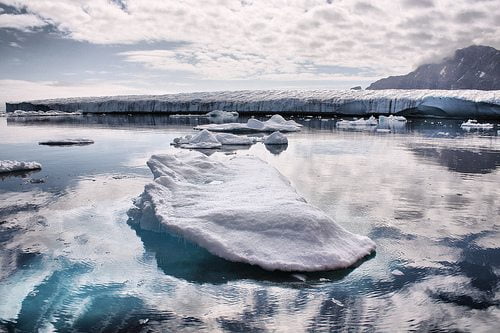
Greenland – 80% of which is ice – experienced its highest temperature since records began on Wednesday.
The new record, 25.9C (78.6F), was measured at Maniitoq Mittarfia near Baffin Bay on the west coast. The previous high was 25.5C (77.9F) at Kangerlussuaq in July 1990, with records dating back to 1958.
Scientists have previously calculated that if the annual average temperature in Greenland increases by 3C (5.4F), its ice sheet will begin to melt at an abnormal and potentially catastrophic rate.
Over three-quarters of the country is covered by the only ice sheet that exists outside of Antarctica. If this were to melt completely, the world’s sea level would rise by more than 7 metres. Even a partial melting could have disastrous consequences for low-lying countries like Bangladesh and the Maldives.
Every year, some surface melting of the Greenland ice sheet is expected in the warmer months. However, 2012 saw an unprecedented melt season. For a few days, 97% of the entire ice sheet showed signs of melting. An iceberg 100 square miles in size – twice the size of Manhattan – broke away from the Petermann glacier in northern Greenland earlier this month.
In 2013 so far, the melt has not made such an intense start, although it was still faster than the recorded average. There has been debate over the cause of the dramatic 2012 melt, with some scientists suggesting it was a freak one-off, rather than a symptom of global warming.
However, recent studies have claimed that Greenland may be near a ‘tipping point,’ meaning higher temperatures could push it into a much more damaging melting cycle.
Last year, statistics emerged describing the extent to which the Arctic, north of Greenland, was melting. Research by the National Snow and Ice Data Centre (NSIDC) in the US suggested that Arctic sea ice cover was at its lowest level since satellite observation began in 1979.
It showed that Arctic ice cover had reduced by 27,000 square miles from the previous record.
NSIDC scientist Walt Meier said, “By itself it’s just a number, and occasionally records are going to get set.
“But in the context of what’s happened in the last several years and throughout the satellite record, it’s an indication that the Arctic sea ice cover is fundamentally changing.”
Further reading:
UN agency reports on ‘decade of climate extremes’
Arctic ice reaches record low, with more melting expected
Comprehensive study shows extent of ice loss increase
Global carbon dioxide levels hit highest levels for three million years


 Business6 months ago
How to Become an Environmentally Conscious Entrepreneur in 2024

 Features11 months ago
5 Reasons That Diamonds Can Be Excellent Green Investments

 Environment12 months ago
Emerging Trends and Advancements in Sustainable Agriculture

 Economy9 months ago
The Circular Economy is Conserving Biodiversity


