Environment
Met Office officially names Abigail as first storm
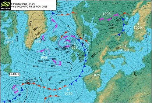
Storm Abigail will bring strong winds across the far north of the UK on Thursday evening into Friday and has the potential to cause some disruption in these areas as a deep low pressure system crosses to the north of the UK.
Yellow and amber National Severe Weather Warnings have been issued for a risk of impacts from wind across parts of Scotland.
Across the far north and northwest of Scotland including the Western Isles and Northern Isles, severe southwesterly gales will develop with gusts of 70-80 mph, perhaps increasing to storm force for a time with gusts of 90mph in exposed locations before the winds gradually ease on Friday.
Much of central and northern Scotland are likely to see severe southwesterly gales later on Thursday with strong winds extending to eastern areas and across the Northern Isles into Friday morning. Gusts of 60-70 mph are likely with the possibility of some gusts exceeding 80 mph in exposed locations.
Winds will increase again from late afternoon on Friday to bring further strong winds across the area, easing overnight.
An additional hazard will be lightning associated with squally showers circulating the storm system.
Paul Gundersen, Chief Operational Meteorologist said: “With wind gusts reaching 60-70 mph widely across the warning area and with gusts of 80 mph and possibly as high as 90 mph in exposed locations there is the potential for disruption to transport, including ferries and power supplies. The strong winds combined with high tides are likely to cause overtopping of coasts and causeways leading to additional hazards.”
Transport Minister for Scottish Government, Derek Mackay has asked people to plan their journeys and prepare for possible disruption to utilities during storm Abigail. He said:
“We know from past experience that winds of this severity can disrupt travel, leading to cancelled ferries and restrictions, or even temporary closures, on bridges. The gale force winds will also make conditions particularly difficult for high-sided vehicles and hauliers should be planning ahead now. Key utilities like power and telecoms can also be impacted by the kinds of conditions forecast and people should try to ensure that they are prepared for possible disruption – this includes checking on the elderly and vulnerable.
“Before heading out, I would urge people to consider the conditions. They should listen to radio reports, visit the Traffic Scotland website or twitter feed and take note of the latest police advice.”
We are expecting the unsettled weather to continue through the weekend but with the emphasis moving from strong winds to heavy rainfall. The heaviest rain is expected to affect parts of Wales, northern England and southern Scotland and we are working closely with Natural Resources Wales, the Environment Agency and SEPA to ensure everyone is prepared for the expected conditions.


The Hidden Environmental Costs of Bus Accidents in NYC

Finding the Best Eco-Friendly Crypto Listing Agencies

Do Eco-Friendly Homes Sell Faster or Just Look Better?

A Breath of Fresh Air: Your Guide to Eco-Friendly Roofs

Eco-Friendly Home Upgrades That Start With Sustainable Tiles

Cool Your Home Naturally: Green Alternatives to Cranking the AC

Cutting Contamination Off At The Tap: Fighting PFAS At The Source

The Hidden Environmental Cost Of Your Grocery List

The Future of eBike Tech: What to Expect in the Next 5 Years

Eco-Friendly Sustainable Building Materials to Consider
Cool Your Home Naturally: Green Alternatives to Cranking the AC
Cutting Contamination Off At The Tap: Fighting PFAS At The Source
The Hidden Environmental Cost Of Your Grocery List
Eco-Friendly Home Upgrades That Start With Sustainable Tiles
Do Eco-Friendly Homes Sell Faster or Just Look Better?
A Breath of Fresh Air: Your Guide to Eco-Friendly Roofs
Finding the Best Eco-Friendly Crypto Listing Agencies